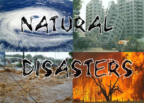
Natural disasters are powerful events caused by the Earth’s dynamic systems. They include earthquakes, volcanoes, hurricanes, floods, tsunamis, tornadoes, and wildfires. Understanding the science behind these disasters is crucial for predicting events, preparing communities, and reducing damage. Scientists study natural disasters through geology, meteorology, oceanography, and environmental science to understand causes, impacts, and preventive strategies.
Earthquakes: Movement of the Earth’s Crust
Earthquakes occur when stress builds up in the Earth’s crust due to tectonic plate movements. The Earth’s lithosphere is divided into several plates that float on the semi-fluid asthenosphere. When plates shift suddenly, energy is released as seismic waves, causing ground shaking. Fault lines, such as the San Andreas Fault in California, are common sites of earthquakes. Scientists use seismographs to measure magnitude and intensity, enabling early warning systems in some regions.
Causes and Types
Earthquakes can be caused by tectonic activity, volcanic eruptions, or human activities like mining and reservoir-induced seismicity. They are categorized as tectonic, volcanic, or induced earthquakes. Tectonic earthquakes are the most common, resulting from plate boundary interactions like subduction, rifting, or transform motion.
Volcanic Eruptions: Magma and Pressure
Volcanoes form when magma from beneath the Earth’s crust reaches the surface. Pressure builds up in magma chambers, and when it exceeds the strength of surrounding rock, an eruption occurs. Volcanoes release lava, ash, gases, and pyroclastic flows, which can devastate nearby areas. Scientists monitor volcanic activity using seismographs, gas sensors, satellite imagery, and thermal cameras to predict eruptions and warn populations.
Types of Volcanoes
Volcanoes are classified as shield, composite, cinder cone, or lava dome based on shape, eruption style, and composition. Shield volcanoes, like Mauna Loa in Hawaii, have gentle slopes and lava flows. Composite volcanoes, such as Mount Fuji, produce explosive eruptions. Understanding volcanic behavior helps communities prepare for hazards like ashfall, lava flow, and lahars.
Hurricanes and Cyclones: Atmospheric Disturbances
Hurricanes, also called cyclones or typhoons depending on location, are powerful storms forming over warm ocean waters. They derive energy from heat and moisture in the atmosphere. The Coriolis effect causes rotation, while low-pressure centers intensify wind speed. Hurricanes can produce heavy rain, flooding, and strong winds, causing widespread destruction.
Predicting Hurricanes
Meteorologists use satellites, radar, and computer models to track hurricane formation, path, and intensity. Forecasting enables evacuation planning, reducing human casualties. Climate change influences hurricane frequency and intensity, making monitoring and research increasingly important.
Floods: Overflow of Water
Floods occur when water exceeds normal levels due to heavy rainfall, snowmelt, river overflow, or dam failure. Urbanization and deforestation exacerbate flooding by reducing natural water absorption. Floods can cause property damage, crop loss, and loss of life, but early warning systems and floodplain management mitigate impacts.
Types of Floods
Floods are categorized as riverine, flash, coastal, or urban floods. Riverine floods develop slowly along rivers, while flash floods occur rapidly in localized areas. Coastal floods result from storm surges, and urban floods occur due to poor drainage. Studying hydrology and topography helps predict and manage floods effectively.
Tsunamis: Oceanic Waves Triggered by Seismic Activity
Tsunamis are giant waves generated primarily by undersea earthquakes, volcanic eruptions, or landslides. When the ocean floor shifts, it displaces large amounts of water, creating waves that travel across the ocean at high speeds. As tsunamis approach shallow coastal areas, wave height increases, causing devastating flooding and destruction.
Detection and Preparedness
Tsunami warning systems rely on seismic monitoring, ocean buoys, and tide gauges to detect wave generation and predict arrival times. Coastal evacuation plans and public awareness are critical to saving lives. Understanding oceanography and tectonics helps scientists model tsunami behavior and reduce impact.
Tornadoes: Rapidly Rotating Columns of Air
Tornadoes form from severe thunderstorms when warm, moist air collides with cold, dry air. Wind shear creates rotation, and a funnel cloud develops, which can touch the ground as a tornado. Tornadoes are measured using the Enhanced Fujita (EF) scale based on wind speed and damage. Meteorologists use radar, storm spotting, and predictive models to warn communities.
Formation and Characteristics
Tornadoes vary in size, wind speed, and lifespan. They can move unpredictably, making preparedness essential. Debris, high-speed winds, and sudden formation make tornadoes among the most dangerous natural phenomena. Understanding atmospheric dynamics and local geography aids in forecasting tornadoes effectively.
Wildfires: Combustion in Natural Landscapes
Wildfires are uncontrolled fires that occur in forests, grasslands, and other natural landscapes. They are fueled by dry vegetation, wind, and high temperatures. Natural causes include lightning strikes, while human activity, such as campfires or discarded cigarettes, also triggers fires. Wildfires release carbon dioxide, degrade air quality, and destroy habitats.
Fire Management
Fire management includes controlled burns, vegetation management, and rapid response teams. Satellite monitoring, firebreaks, and public awareness help prevent and contain wildfires. Climate change, prolonged droughts, and urban expansion increase wildfire risk, emphasizing the importance of environmental science in disaster management.
Scientific Approaches to Disaster Preparedness
Understanding the science behind natural disasters enables communities to prepare and reduce risks. Hazard mapping, early warning systems, structural engineering, and public education are essential strategies. Governments and international organizations collaborate to implement disaster risk reduction policies, ensuring timely evacuation, infrastructure resilience, and emergency response planning.
Role of Technology
Modern technology plays a vital role in disaster prediction and management. Satellites provide real-time monitoring of storms, wildfires, and volcanic activity. Drones assess damage and survey affected areas. Big data and AI model disaster scenarios to improve emergency preparedness and optimize resource allocation.
Community Awareness and Education
Public education campaigns teach people how to respond during disasters. Emergency drills, evacuation routes, and communication strategies save lives. Understanding the scientific causes of disasters helps communities recognize risks and respond effectively, reducing casualties and economic losses.
Conclusion
The science behind natural disasters reveals the complex interactions of geological, atmospheric, and environmental processes. Earthquakes, volcanoes, hurricanes, floods, tsunamis, tornadoes, and wildfires are natural phenomena influenced by tectonics, weather, climate, and human activity. Studying these disasters allows scientists to predict, prepare, and mitigate their impacts. Technology, research, and public awareness are critical in building resilient communities and safeguarding lives and property. Understanding natural disasters scientifically is essential for a sustainable and safe future in an ever-changing world.